| 1600-1700 Map of Newtown | Queens County |
| 5 Borough | Queens & Richmond Counties |
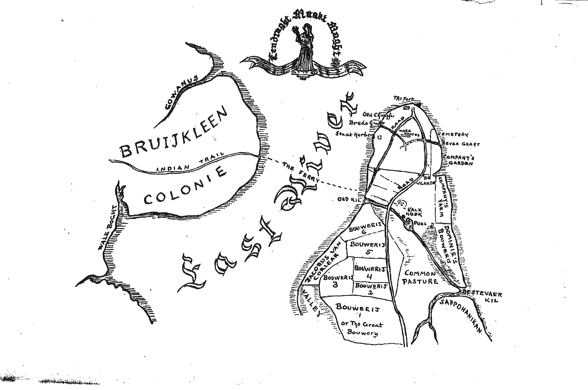
| 1854 Corona | West Flushing |
| ASTORIA | 1873 Map Land divisions,streets,plot owners |
| East ASTORIA | 1873 Map Land divisions,streets,plot owners |
| BLISSVILLE (Part of Long Island City, Queens Co.) | Johnson's 1873 Map of land divisons of plot owners with main street dividers |
| COLLEGE POINT | Johnson's 1873 Map of land divisons of plot owners with main street dividers |
| CORONA or West FLUSHING | Johnson's 1873 Map of land divisons of plot owners with main street dividers |
| DOUGLASTON | Johnson's 1873 |
| DUTCH KILLS(Part of Long Island City, Queens Co.) | Johnson's 1873 Map Land divisions,streets,plot owners |
| EAST WILLIAMSBURGH | Newtown.. Johnson's 1873 |
| FAR ROCKAWAY | 1873 Map Land divisions,streets,plot owners |
| FLUSHING 1 | (different areas)Johnson's 1873 Map Land divisions,streets,plot owners |
| FLUSHING 2 | (different areas)Johnson's 1873 Map Land divisions,streets,plot owners |
| FLUSHING 3 | (different areas)Johnson's 1873 Map Land divisions,streets,plot owners |
| FLUSHING (Part of) | (different areas)Johnson's 1873 Map Land divisions,streets,plot owners |
| HEWLETT | Johnson's 1873 Map Land divisions,streets,plot owners |
| HINSDALE | Johnson's 1873 Map Land divisions,streets,plot owners |
| INGLEWOOD | 1873 Map Land divisions,streets,plot owners |
| JAMAICA Village | 1873 Map Land divisions,streets,plot owners |
| LITTLE NECK | 1873 Map Land divisions,streets,plot owners |
| LONG ISLAND CITY | Johnson's 1873 Map of Long Island City/Queens Co. |
| MASPETH | 1873 Map Land divisions,streets,plot owners |
| NEW BRIDGE | Johnson's 1873 Map Land divisions,streets,plot owners |
| NEWTOWN | Johnson's 1873 Map Land divisions,streets,plot owners |
| PEARSALLS | Johnson's 1873 Map Land divisions,streets,plot owners |
| RAVENSWOOD | Johnson's 1873 Map Land divisions,streets,plot owners |
| RICHMOND HILLS | Johnson's 1873 Map Land divisions,streets,plot owners |
| ROCKAWAY/WOODSBURGH | 1873 Map Land divisions,streets,plot owners |
| ROCKVILLE CENTER | Johnson's 1873 Map Land divisions,streets,plot owners |
| SPRINGFIELD STORE | 1873 Map Land divisions,streets,plot owners |
| VALLEY STREAM | Johnson's 1873 Map Land divisions,streets,plot owners |
| WHITESTONE VILLAGE | 1873 Map Land divisions,streets,plot owners |
| WILLOWTREE STATION | 1873 Map Land divisions,streets,plot owners |
| WINFIELD | 1873 Town of Newtown |
| WOODHAVEN | 1873 Map Land divisions,streets,plot owners |
| South WOODHAVEN | 1873 Map Land divisions,streets,plot owners |
| WOODSBURGH | 1873 Map Land divisions,streets,plot owners |
| WOODSIDE | 1873 Map Land divisions,streets,plot owners |
| F. W. Beers 1873 Atlas of Long Island | PDF format
|