ENUMERATION - WARDS
THE ED's & WARDS follow below...
Brooklyn..5 Dutch Towns
Also :
So essential when trying to determine the Enumeration/Assembly Districts are 
MAPS

A small intro....from N.A.R.A.
The microfilm reproductions are on 156 rolls of 35 film 513 original 
volumes of descriptions of geographic subdivisions (enumeration districts) 
that were used in the decennial United States censuses from 1830 to 1950. 
These records are part of Record Group 29, Records of the Bureau of the Census.
The Census subdivisions or enumeration district served as the basic geographic 
area of a size that could be covered by a single census taker (enumerator) 
within one census period. 
It may have been as large as one county or as small as part of a city block. 
The term "subdivision," referring to a part of the supervisor's or marshall's 
division or district, was used in the early censuses. With the 1880 census 
the term changed to "enumeration district" & the census taker was officially 
called an "enumerator."
With the early 'subdivision' use the Street ward index and the 
maps as finding aids.

From FORGOTTEN NEW YORK
New York City used to have political designations called wards, which were the smallest political 
units in NYC. Each ward elected an alderman and an assistant alderman to the City Council. 
According to The Encyclopedia Of New York City (1995, Yale University Press) the system goes all 
the way back to 1686, when Governor Thomas Dongan divided the city, then entirely in Manhattan, 
into six wards. In 1791, wards were given numerical designations. 

The First Ward was the tip of Manhattan, and districts were given consecutive numbers the further 
north you went in Manhattan. New wards were added as the city expanded northward,and increasing 
population of the older wards required subdivision.

The "ward boss", the local provider of patronage and vote gatherer, was a most important element 
in the power of Tammany Hall, the pre-eminent political machine in the latter half of the 19th 
Century. Ward politics diminished in stature beginning with the 20th Century, and wards were 
formally abolished in 1938.
Brooklyn was also composed of wards. When it became a city in 1837, it was divided into nine wards, 
and by the time of consolidation with New York City in 1898 it had 32 wards.

OBSOLETE STREET NAMES / CHANGES
NEW LOTS..OBSOLETE STREET NAMES / CHANGES

ALL OUR HARD Work..made easy
Obtaining AD/ED for the 1905/15/25 New York State Census in One Step

BROOKLYN
1839 Bklyn Street Index
1850 Wards Brooklyn
1854-55 Ward Boundaries
1855 Brooklyn 1 - 12th WARD MAPS
1860/1878 Street Index by WARDS..BKLYN
1860 Ward Enumeration Districts
1865 Streets in Wards 14-15-16-17-18-19th Kings Co.
1866 Johnson's Bklyn Map
1867 Wards 1-32
1870 Ward Boundaries/Federal Census Subdivision & Wards Bklyn
1870 Ward#-Roll# LONG ISLAND Bklyn/Queens/Suffolk
1870 Ward Map
1870 Wards
1872 1-28th WARDS/Street Index City of Brooklyn
1875 STATE CENSUS ELECTION DISTRICTS 
WARDS 1 thru 25
(WARD 6 is NOT transcribed as of yet)
Note: In the state census Election Districts were used NOT Enumeration Districts.
1880 BROOKLYN/KINGS ENUMERATION DISTRICTS/WARDS
1889 18th Ward into 3 Wards
1889 Brooklyn Ward Boundaries
1876 ELECTION Districts & Ward Boundaries
1889 ELECTION Districts & Ward Boundaries
1891.1892 Ward boundaries
1892 4-6-7-16-18th Ward State Census Eds/streets
1893 Brooklyn Ward Boundaries
WARDS and how they changed
1897 J.B.Beers & Co..WARD Boundaries
1900 BROOKLYN/KINGS ENUMERATION DISTRICTS/WARDS
1900 Election Districts in Brooklyn..First thru Sixteenth Wards
1903 Brooklyn Ward Boundaries
1903 Brooklyn Assembly Districts
1905 Bklyn Assembly Districts / Streets
1906 ELECTION w/Enumeration/Assembly Districts
1910 BROOKLYN/KINGS ENUMERATION DISTRICTS/WARDS 1-5
1910 BROOKLYN/KINGS ENUMERATION DISTRICTS/WARDS 6-10
1910 BROOKLYN/KINGS ENUMERATION DISTRICTS/WARDS 11-15
1910 BROOKLYN/KINGS ENUMERATION DISTRICTS/WARDS EDs 16-20
1910 BROOKLYN/KINGS ENUMERATION DISTRICTS/WARDS EDs 21-25
1910 BROOKLYN/KINGS ENUMERATION DISTRICTS/WARDS EDs 26-31
1910 BROOKLYN/KINGS ENUMERATION DISTRICTS..One Step
1913 Brooklyn Map with WARDS
1915 Brooklyn A.D. Map & Wards by Neighborhoods
1915 Brooklyn Ward Boundaries
1915 Brooklyn Assembly Districts
1920 BROOKLYN/KINGS ENUMERATION DISTRICTS/ASSEMBLY DISTRICTS
1920 BROOKLYN/KINGS ENUMERATION DISTRICTS..One step
1920-E.D.s #1029-1069 Streets List
1920-Roll# #1160-61/1171-72 E.D. Street List
1925 Map Outline..Assembly Districts..Bklyn
1925 Assembly District#20 /E.Ds 1-64
1930 BROOKLYN/KINGS ENUMERATION DISTRICTS..One Step
1930 Kings..(USGenWeb Census Project) EDs, ADS, and what institutions, area can be found on what rolls
1930 Enumeration District Orphanages & Institutions..Brooklyn
1957 Assembly Districts Outline Map...Brooklyn

NY state Library Albany has an index to ED's & AD's by street/house address for years 1905/1915/1925 State census. Also available at Family History Center. Searching Manhattan can be truly difficult. When all else fails, E-Mail NYPL at: mapref@nypl.org

MANHATTAN
1683 City of New York..6 Wards
1850 City of NEW YORK ENUMERATION DISTRICTS
1852 New York City WARD MAPS
State Census 1855 Election District Bounadries Manhattan
1855 Streets Index - Wards
1860 Street Index Manhattan
1864 Wards
1870 New York City FIRST ENUMERATION DISTRICTS
1870 New York City 2nd ENUMERATION DISTRICTS
1870 E.D.s for the 2nd Enumeration 1st-11th-13th Ward (Streets/Eds)
1870 The 2d Enumeration 17th Ward NYC Streets with house numbers
1878 Manhattan Street Index
1880 MANHATTAN ENUMERATION DISTRICTS/WARDS
1900 Manhattan Ward Boundaries
1903 Ward Boundaries Manhattan
1903 Assembly/Alderman Districts Manhattan & Bronx
1905 Assembly District Map Manhattan
1910 Ward Boundaries Manhattan & Bronx
1910 Manhattan ENUMERATION DISTRICTS..One Step
1915 Ward Boundaries & Assembly Districts Manhattan
1915 New York City E.D.s 1---18 & house #s
1920 Manhattan ENUMERATION DISTRICTS..One step
1925 New York City Street Index
1925 New York Assembly District Map
1930 ENUMERATION DISTRICTS..One Step

QUEENS
1880 Breakdown of Queens Census by EDs of Towns
1903 Ward Boundaries & Assembly Districts Queens
1910 Ward Boundaries & Assembly Districts Queens
1910 Queens ENUMERATION DISTRICTS..One Step
1910 Queens Enumeration Second Supervisors District
1915 Street Listings, Ridgew'd (pt) AD 3 Ward 2
1915 Street and House Number Locations..
NYS Census..Queens
Listed Alphabetically
Partial: 
Ridgewood, Ridgewood Station, Ridgewood Heights, 
Evergreen and Glendale only.  
AD 3, ED’s 10-41 & 56
1915 Street & House Number Locations..AD #3..ED #10 thru 41 & 56
1920 Queens ENUMERATION DISTRICTS..One step

BRONX
The Bronx..When it came into it's own
1903 Assembly/Alderman Districts Manhattan & Bronx
1905 Assembly Districts / Ward Boundaries Map
1910 Ward Boundaries Manhattan & Bronx
1910 Bronx ENUMERATION DISTRICTS..One Step
1915 Ward Boundaries & Assembly Districts Bronx
1920 BRONX ENUMERATION DISTRICTS..One step
1930 ENUMERATION DISTRICTS..One Step

RICHMOND
1903 Ward Boundaries Richmond
1910 Staten Island ENUMERATION DISTRICTS..One Step
1915 Ward Boundaries & Assembly Districts Richmond
The History of Staten Island
1912 Street name changes
Street name changes in Staten Island

For locating Census Rolls from NARA..SCLS..FHC : CENSUS * "The Enumeration Districts in the 1900 Soundex Census only go up to E.D.'s in the 500's. A number of cards from this index are in the 800's. These 800 E.D.'s are filed out of order. Ex.(E.D.809 follows E.D 280). The only way I was able to find it was by using the volume number which you can find on the roll of microfilm itself. Each roll usually has one or two volumes. My advice would be to use these volume numbers if you have other E.D.s in Brooklyn that are that high. It seems like the enumerators had to go back to a previously missed area, and that is why the E.D.s are so high. Hopefully this will help you and the researchers. If you have any further questions, please feel free to contact us. Katherine Vollen Archives I Research Room Services Branch (NWCCR1) National Archives and Records Administration 700 Pennsylvania Ave., NW Washington, DC 20408-0001 www.nara.gov"

THE BRONX The Bronx stood alone as a borough beginning in 1898; but as a county, the Bronx had to wait some 16 years until 1914. From 1683 until 1873, the Bronx was part of Westchester County. In 1873, the western Bronx -- that area west of the Bronx River and south of the City of Yonkers -- was annexed by the city and county of New York. In 1895, the remaining part of the Bronx was annexed by the city and county of New York. The Bronx was then known as the northern annex. In 1898, after the consolidation with the City of Brooklyn (Kings County), Richmond County and the western-third of Queens County (Long Island City, the Towns of Newtown, Flushing and Jamaica, and the Rockaway peninsula of the Town of Hempstead), New York City was administratively divided into 5 boroughs (Manhattan, the Bronx, Brooklyn, Queens and Staten Island) but consisted of only 4 counties (New York, Kings, Queens and Richmond). The Bronx while a separate borough remained part of New York County. In 1914, the Bronx County -- the 62nd and last county in New York State -- seceded from New York County. New York City then had 5 boroughs and 5 counties. (In 1899, the eastern two-thirds of Queens County -- the portion not in New York City -- seceded and formed Nassau County.) With many thanks to Walter Greenspan and his ever knowing knowledge of boundaries and towns
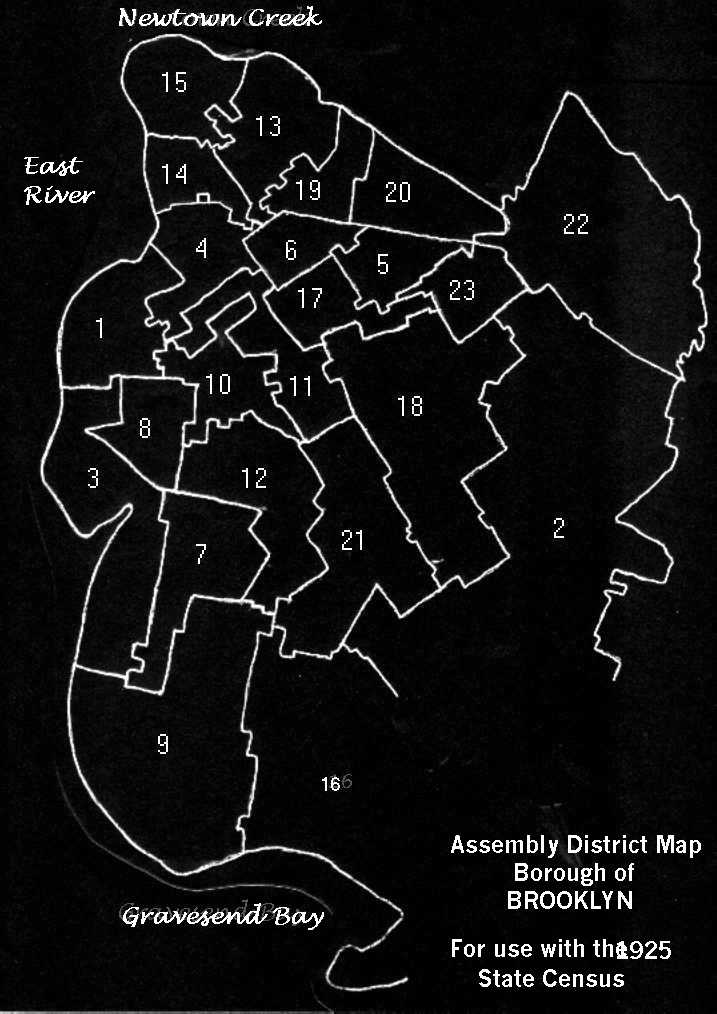
 OTHER BROOKLYN MAPS There is a FHC film #1377700 (AKA: US5-413 Roll 19501) called Ward maps of some US cities 1800's. Return to ENUMERATION / WARDS Main Return to BROOKLYN Main